Mapnik 4.2.1 Release Jan 28, 2026 | Artem Pavlenko
Mapnik 4.2.0 Release Dec 30, 2025 | Artem Pavlenko
Mapnik 4.1.4 Release Nov 06, 2025 | Artem Pavlenko
Mapnik 4.1.3 Release Oct 01, 2025 | Artem Pavlenko
Mapnik 4.1.2 Release Aug 03, 2025 | Artem Pavlenko
Mapnik 4.1.1 Release Jun 27, 2025 | Artem Pavlenko
Mapnik 4.1.0 Release Jun 01, 2025 | Artem Pavlenko
Mapnik 4.0.7 Release Apr 05, 2025 | Artem Pavlenko
Mapnik 4.0.6 Release Mar 02, 2025 | Artem Pavlenko
Mapnik 4.0.5 Release Jan 31, 2025 | Artem Pavlenko
Mapnik 4.0.4 Release Dec 04, 2024 | Artem Pavlenko
latest news
Cartographic trick of the day
Apr 20, 2012
This is a short post to share some techniques I came up with while implementing compositing and image filtering in Mapnik core.
The problem
Text rendered on top of a ‘busy’ map can become difficult to read, it can make colours appear heavy. One use-case would be place names on top of a dense road network, another text on top of height contours.
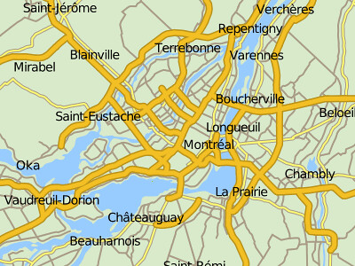
Consider the following map generated with :
python mapnik/demo/python/rundemo.py
(I modified text size to be 14px for clarity)
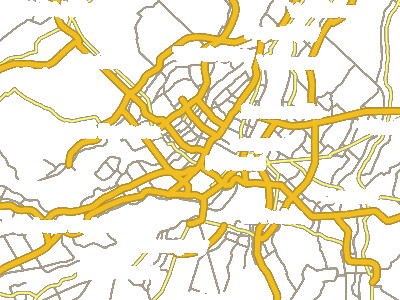
As you can see, dark text interferes with dark-ish minor roads and also casings on bigger roads.
One way to address this is to use text halos :
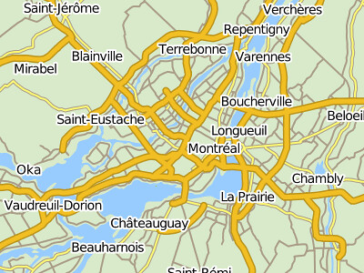
Now we have nice ‘punchy’ text but the rest of the features are getting overwhelmed. This is a sub-optimal solution, though, as halos saturate the image and attract far to much attention to the text items. What we really want is to punch-out the interfering layers around the text but leave the background intact.
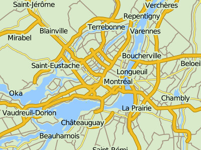
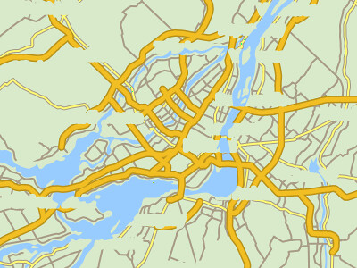
This is better - now we have a map that is lighter on the eye and the text is easier to read. After all, this is the main purpose of a map - to convey information to the user.
Note that province and water polygons are underneath halos, while roads have been removed.
So how can we achieve this in Mapnik?
The solution
This is a well known cartographic issue and the solution in the paleo-geo world is referred to as “variable-depth masking”. I call it ‘smart-halo’ but the principle is the same.
There are possibly multiple ways to solve this, but here is one solution based on recent ‘compositing’ work I was concentrating on in Mapnik.
So here are step-by-step maps demonstrating the process.
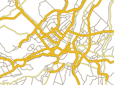
1) We start with an empty map with fully transparent background - ‘transparent’ named colour or rgba(0,0,0,0). Then we render roads in the usual way.
NOTE: black background is due to conversion to JPEG format which doesn’t support alpha channel. It should appear as white
2) Right after roads we insert ‘smart-halo’ layer with the following style
<Style name="smart-halo" comp-op="dst_out">
	<Rule>
       <TextSymbolizer face-name="DejaVu Sans Book" halo-radius="3" halo-fill="white" fill="white"  size="14">[GEONAME]</TextSymbolizer>
    </Rule>
  </Style>
We use ‘dst_out’ compositing mode on this style to ‘punch-out’ roads or any other previously rendered objects.
3) Now we add provinces and water polygons using “dst_over” compositing operator, e.g for water polygons:
<PolygonSymbolizer fill="rgb(153,204,255)" fill-opacity="1.0" smooth="0.7" comp-op="dst_over"/>
4) And finally we render text and there you have it - smart-halos :D